Case study 1: the Cottam project
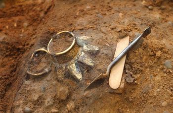
The presence of Anglian and Anglo-Scandinavian settlements at Cottam, East Yorkshire, was first indicated in 1987 by numerous finds by metal detector users of coins, dress pins, strap ends and other copper alloy artefacts. The Department of Archaeology, University of York, carried out a programme of fieldwork on the site between 1993-1995 which included fieldwalking, geophysical survey and excavation (Richards 1999; 2001). The digital archive has been deposited with the ADS, while the finds and paper archive from the project are deposited with Hull Museum.
The geophysical survey was carried out between October and December 1994. The aim of the survey was to produce a detailed map of sub-surface geophysical anomalies within two sites defined by concentrations of metal finds. The southern concentrations also coincided with a cropmark enclosure. The survey was also to act as a pilot study to assess the relative effectiveness of magnetic and earth resistance techniques in mapping anomalies in this area.
Two survey areas were located in the northern part of the large field to the west of Burrow House Farm. Area 1 (NGR 49760 46674) was situated over the central and eastern part of the concentration of cropmarks forming a large enclosure with several associated smaller enclosures. Area 2 (NGR 49763 46690) was sited over two small sub-rectangular enclosures to the north-east of the larger cropmark site. Both areas were subsequently examined by excavation.
In the field the geophysical data were downloaded from the surveying instruments (an RM4 earth resistance meter and an FM18 fluxgate gradiometer) onto a laptop and processed using Geoplot version 2.02. The processed data were transferred to Surfer version 6 and prepared for presentation.
The digital Archive created by the Cottam project is a research level archive and has been deposited with the ADS. The Archive consists of:
- ‘Level III’ reports covering the stratigraphic sequence
- Fieldwalking, metal detector, geophysical survey reports
- Specialist reports: animal bone, flint, pottery, plant macrofossils
- Geophysics data
- Finds database
- Context database
- CAD files, including a rectified aerial photographic plot
- Colour images of many of the finds
Metadata records were created for the Cottam project as a whole and for individual survey types. Table 3 (below) shows the earth resistance survey documentation for Area 1.
Table 3: Cottam Area 1 Earth Resistance Survey Documentation
| Project Information | |
|---|---|
| Survey name | Burrow House Farm, Cottam |
| Survey index | Area 1 – COT93 – Earth Resistance – CTR1K |
| Survey purpose | The aim of the survey was to produce a detailed map of sub-surface geophysical anomalies within two sites defined by concentrations of metal finds. One concentration also coincided with a cropmark enclosure. The survey was also to act as a pilot study to assess the relative effectiveness of magnetic and earth resistance techniques in mapping anomalies in this area. |
| Report summary | Although high resolution magnetic survey proved itself to be the most effective technique in mapping sub-surface archaeological remains, the results of the soil resistance survey clearly provide valuable complementary information on variations in soil compaction as well as identifying features with non-magnetic backfills. The survey provided detailed maps of two sites coarsely defined through aerial photography. The results also indicate basic zonation within these sites based on feature density and variations in soil compaction. |
| Bibliographic references | Richards, J.D. 1999 ‘Cottam: An Anglian and Anglo-Scandinavian settlement on the Yorkshire Wolds’ Arch J 156, 1-110
Richards, J.D. 2001 ‘Anglian and Anglo-Scandinavian Cottam: linking digital publication and archive’, Internet Archaeology 10, http://intarch.ac.uk/journal/issue10/richards_index.html Survey report: http://archaeologydataservice.ac.uk/archives/view/cottam_ba/geophys.cfm |
| Survey keywords | Earth Resistance, Settlement, Anglian, Anglo-Scandinavian |
| Spatial coverage | Area 1: 497565,466700 to 497644,466779 |
| Administrative area | Cottam |
| State | East Riding of Yorkshire |
| Country | England |
| Solid geology | Chalk |
| Drift geology | Not reported |
| Duration | October-December 1994 |
| Weather | Not reported |
| Soil condition | Not reported |
| Land use | Arable |
| Monument type | Settlement |
| Monument period | Early medieval |
| Scheduled Ancient Monument (SAM) number | Not scheduled |
| Surveyor | Field Archaeology Specialists, Department of Archaeology, King’s Manor, York, YO1 7EP |
| Client | Julian Richards, Department of Archaeology, University of York, King’s Manor, York, YO1 7EP |
| Depositor | Julian Richards, Department of Archaeology, University of York, King’s Manor, York, YO1 7EP |
| Primary archive | Archaeology Data Service: http://archaeologydataservice.ac.uk/archives/view/cottam_ba/ |
| Related archives | Digital archive: http://archaeologydataservice.ac.uk/archives/view/cottam_ba/ Physical archive: Hull Museum |
| Copyright | Julian Richards |
| Term list | Not reported |
| Geophysics metadata | |
| Survey type | Earth resistance survey |
| Instrumentation | RM4 Earth Resistance Meter |
| Probe configuration | PA1 twin-electrode probe array |
| Probe spacing | 0.5 m |
| Reasons for choice of survey technique | The survey was to act as a pilot study to assess the relative effectiveness of magnetic and earth resistance techniques in mapping anomalies in this area. |
| Area surveyed | 0.64 ha |
| Method of coverage | Regular grid, Zigzag |
| Traverse separation | 1 m |
| Line separation | 1 m |
| Reading interval | 1 m |
| Sampling position | Centre of each 1 m x 1 m square |
| Data grid size | 20 m x 20 m |
| Accuracies | The location of each measurement point is accurate to 0.1 m with respect to the data grids. |
| Survey methodology | All data grids have the same size and resolution. The arrangement of data grids is captured in the file mesh.csv. The survey direction was in positive x-direction, subsequent lines were added in negative y-direction, following a zigzag pattern. |
| Data treatment | The raw data were processed using Geoplot version 2.02. This involved the adjustment of any differences in the average background reading between individual survey grids as well as inconsistencies caused by electrode repositioning or changing climatic conditions. The data were interpolated to 0.5 m x 0.5 m to provide a smoother image of the data. The processed data were transferred to Surfer version 6 in which it was prepared for presentation. |
| Report | |
| Report title | Cottam B Geophysical Survey |
| Report reference number | COT01 |
| Report author | Justin Garner-Lahire |
| Report holder | Field Archaeology Specialists |
| Geophysics georeferencing | |
| Geophysics coordinate system | Baseline 1 was laid out 2 m west, and parallel with the field boundary to the east, starting 5 m north of the intersection with the wall in the south of the field. This starting point has coordinate (60 m, 0 m) in the geophysics grid, running parallel with its y-axis. |
| Georeferencing | Two points of the geophysics grids (A, B) were measured with tapes from two positions in the field (C, D; see map figure): A = (20 m, 60 m); B = (80 m, 60 m); C = SW corner of concrete base of pylon; D = NW edge of northern concrete gate post in eastern field boundary.
AC = 21.4 m; AD = 33.2 m; BC = 22.3 m; BD = 11.4 m. |
| File description | |
| Explanation of codes used in filenames | ct = Cottam r = Earth resistance 1 = Area 1 |
| Description of file formats | Geoplot 2.02 data grids (.dat, .grd, .his, .sta) and plotmesh (.plm) Surfer files (.srf) |
| Date of last modification | April 1995 |
Acknowledgements
The fieldwork at Cottam was conducted under the auspices of the Department of Archaeology, University of York, and principally funded by the British Academy and the Earthwatch Foundation